Zone 7’s Service Area

Overview

Water reservoir with green hills in the distance

Zone 7 supplies treated drinking water to retailers serving over a quarter million people in the Tri-Valley area including the cities of Pleasanton, Livermore, Dublin and, through special agreement with the Dublin San Ramon Services District, to the Dougherty Valley area. Additionally, we supply untreated water directly to agricultural businesses for irrigation of 3,500 acres, primarily South Livermore Valley vineyards.

We also maintain 37 miles of local flood-protection channels, about a third of all the Valley’s channels and creeks. The remaining channels are owned either privately or by other public agencies responsible for repairs and maintenance.

Continue reading to find your retailer or see maps of our service area.

Post

Find Your Retailer

As a wholesaler, we work collaboratively with our network of retailers to ensure seamless delivery of safe, clean water to the Tri-Valley community. Need help contacting your retailer? Select from the list below or check our Maps page to see each jurisdiction area.

The City of Pleasanton Logo

City of Pleasanton Operations Services
3333 Busch Road, Pleasanton, CA 94566
Monday – Friday, 7 a.m. – 3:30 p.m.
(925)-931-5500

The City of Livermore Logo

City of Livermore Water Resources Division
101 W. Jack London Blvd., Livermore, CA 94551-7632
Monday – Friday, 8:00 a.m. to 4:00 p.m.
(925) 960-8100

California Water Service Logo

California Water Service
195 South N Street, Livermore, CA 94550
Monday – Friday, 8:30 a.m. to 5:00 p.m.
(925) 447-4900

Dublin San Ramon Services District Logo

Dublin San Ramon Services District
7051 Dublin Blvd., Dublin, CA 94568
Monday – Friday, 8:00 a.m. – 5:00 p.m.
(925) 828-0515

Post

Maps

Find Your Way Around Zone 7

Zone 7 is located in Eastern Alameda County and serves the Tri-Valley community, including the cities of Livermore, Pleasanton, Dublin, San Ramon and part of Dougherty. These maps will give you an idea of our location, service area and other helpful information.
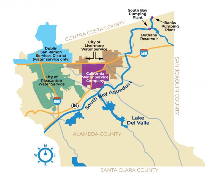
Service Area Map

This map shows Zone 7’s service area boundaries, including areas that are served by each of our four water retailers. The other areas within our service boundaries consist of agricultural or business customers, whom we service directly.

Learn more in Find my Retailer.
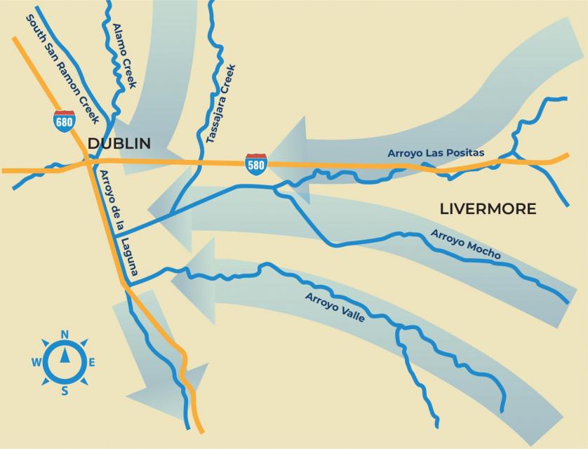
A map showing the flow of the South Bay Aqueduct through the Tri-Valley Area and the service areas of the four retailers

Download as a PDF

WATER WAYS MAP

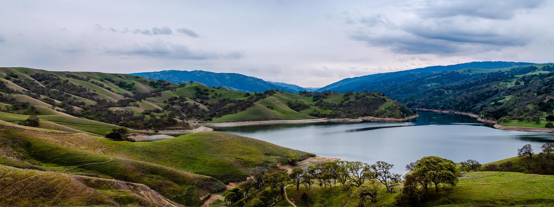
This map shows how stormwater flows through our watershed. During a rain event, water makes its way from our streams and arroyos into these larger flood channels and rivers and eventually out to San Francisco Bay and the Pacific Ocean. It is important to remember that stormwater runoff also carries pollution through these waterways and out into the San Francisco Bay.

Learn more in Protecting our Watershed.
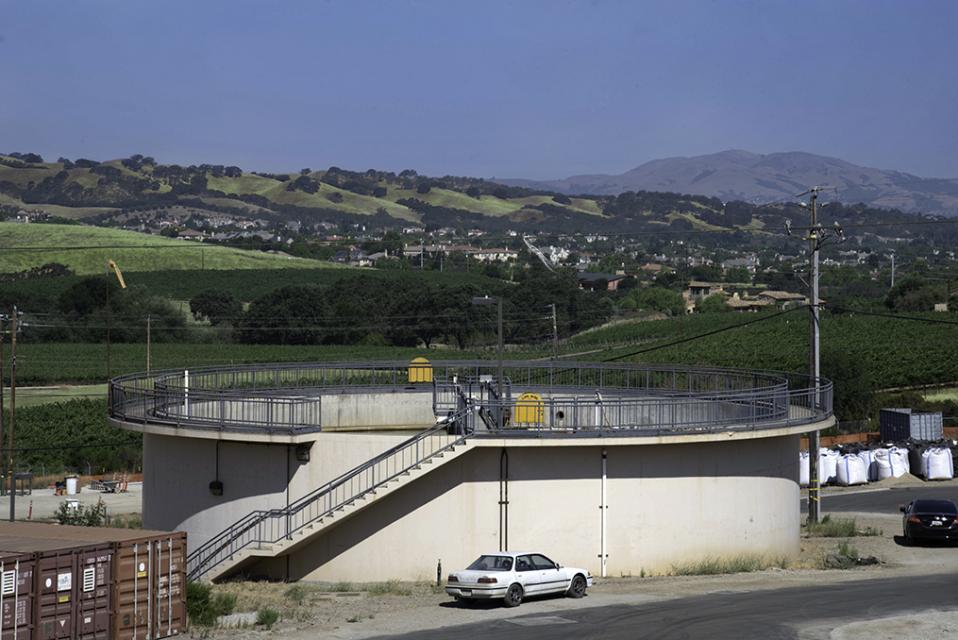
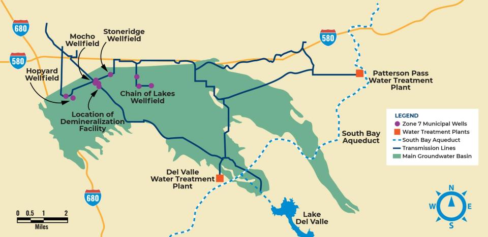
A map of the various arroyos flowing in the Tri-Valley area

Download as a PDF

Facilities Map

Zone 7 operates two surface water treatment plants, a groundwater demineralization plant, and a network of groundwater wells. Additionally, we are charged with managing our groundwater basin, a valuable resource for the Tri Valley.

Learn more in Water Treatment Facilities.

A map indicating the water treatment facilities and wellfields in the Tri-Valley area

Download as a PDF

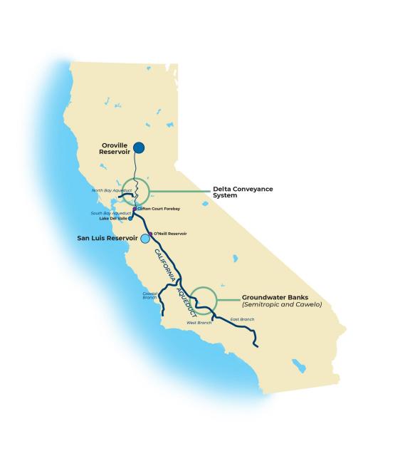
State Water Project Map

This map shows the major pieces of infrastructure of the State Water Project. Zone 7 is one of twenty-nine state contractors across the state of California that participate in this state run partnership to manage water infrastructure that provides an annual allotment of water to each of the partners. Created by approval of voters in 1960 – the State Water Project is considered one of the greatest engineering achievements of the 20th Century.

Learn more in Water Reliability.

A map of the State of California showing the Oroville Reservoir, the Delta Conveyance System and the groundwater banks utilized by Zone 7 in Southern California

Download as a PDF